
Submitted by Alusiv on
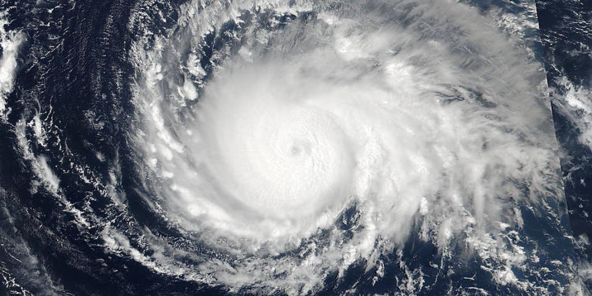
All eyes are on the skies and satellites as Hurricane Irma blasts across the Caribbean and towards the coast of Florida on September 9. The largest storm ever witnessed, Irma is being tracked by agencies around the globe. The NASA-NOAA Suomi NPP (National Polar-orbiting Partnership) satellite captured this high-resolution, visible-light image of Hurricane Irma on Sept. 4, before it was upgraded to a Category 5 storm. Read more about the tracking of the storm here.

